 sddot.com


US Highway 16CORRIDOR STUDY
Public Meeting Open House
Thursday, Dec. 14, 2023
5:30-7 p.m. Mountain Time
Black Hills Energy Event Center (enter through lobby)
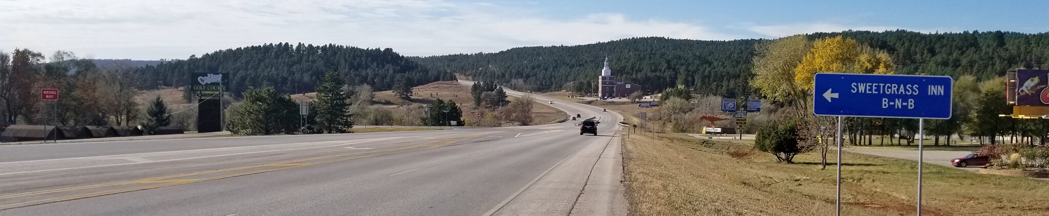
7001 Mount Rushmore Road, Rapid City, SD 57701
More Info
About
Planning for the future of South Dakota’s driveway to Mt. Rushmore
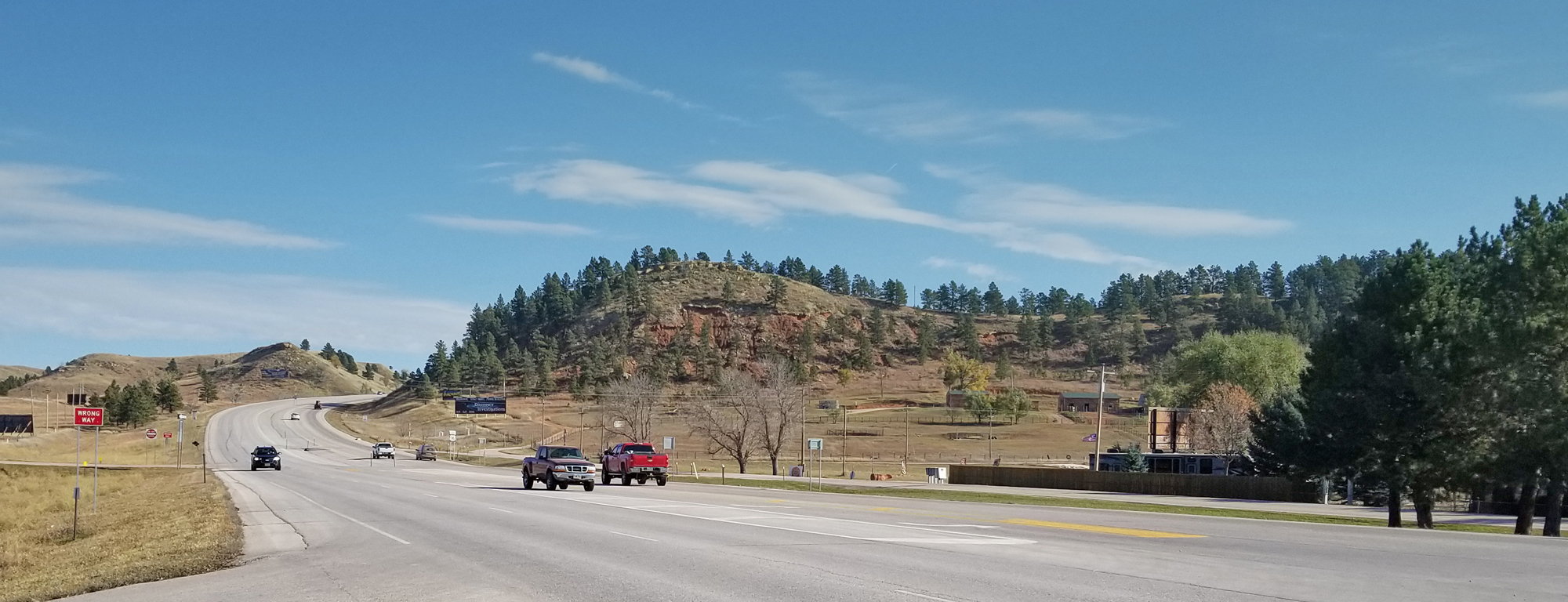
The South Dakota Department of Transportation (SDDOT) initiated a study of over 16 miles of U.S. Highway 16 between Cathedral Drive/Fairmont Boulevard in Rapid City and the Keystone Wye to address growing traffic volumes and other challenges throughout the area. The corridor is constantly evolving, whether day to day or year to year. Continued development in the area led to notable increases in traffic that are consistent throughout the year. During the summer the corridor sees a spike in tourism-related traffic that brings motorists unfamiliar with the area and a diverse mix of vehicle types.
This study is a collaborative effort between the SDDOT, FHWA, Rapid City MPO, Rapid City, Pennington County, stakeholders, and the public to develop a comprehensive plan for the corridor. This study will serve as a guide to the SDDOT and other agencies along the corridor for future improvements to address needs well into the future.
STUDY AREA MAP
Study Highlights
- Overall U.S. 16 Corridor StudyFinal Reports
- Sub-Area Analysis (East of Rockerville to West of Neck Yoke Road)Sub-Area Analysis
- U.S. 16/U.S. 16B/Catron Boulevard Single Point Interchange (SPI) Study Recommendation
- U.S. 16/Neck Yoke Road Reduced Conflict Intersection (RCI) Study Recommendation
- Nov. 22, 2022 Public Meeting InfoPublic Meeting
- Environmental – coming soon

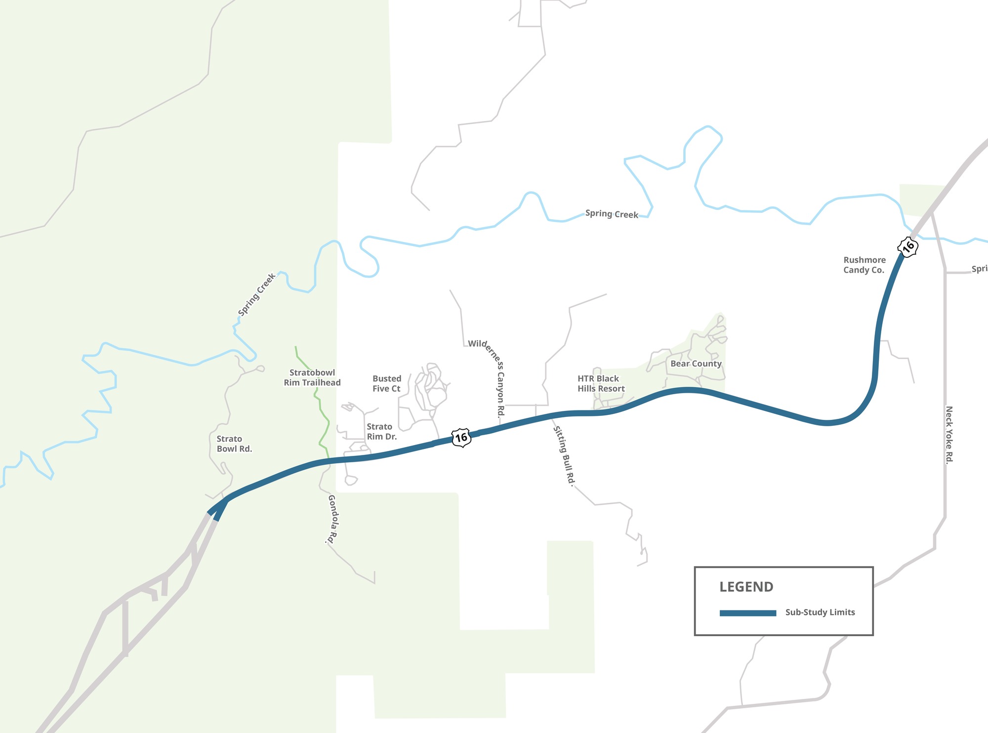
Sub-Area Analysis
East of Rockerville to west of Neck Yoke Road
In 2019, the South Dakota Department of Transportation (SDDOT) initiated a study of over 16 miles of U.S. Highway 16 between Cathedral Drive/Fairmont Boulevard in Rapid City and the Keystone Wye to address growing traffic volumes and other transportation needs throughout the area. This study is a collaborative effort between the SDDOT, Federal Highway Administration (FHWA), Rapid City Area Metropolitan Planning Organization (MPO), City of Rapid City, Pennington County, stakeholders, and the public to develop a comprehensive plan for the corridor.
Since the release of the U.S. 16 Corridor Study final report in July 2021, the SDDOT identified a need for further detailed analysis and refinement of alternatives along a U.S. Highway 16 segment from just east of Rockerville to just west of the Neck Yoke Road intersection. Rockerville and Neck Yoke Road intersections are not included in this sub-area.
Sub-Area Map
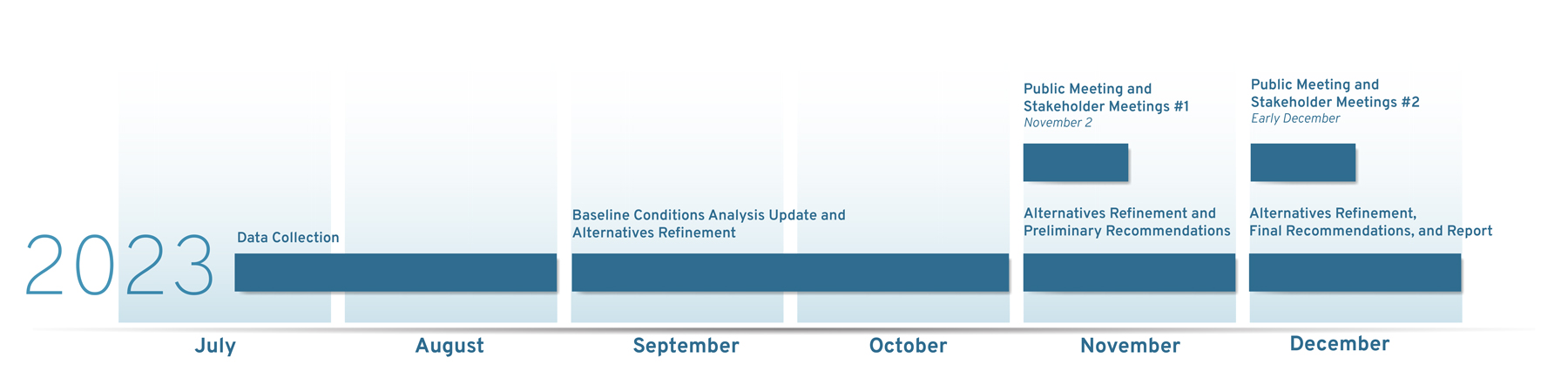
Schedule
Objectives
DEVELOP

- A long-range plan for the U.S. Highway 16 corridor, which includes the evaluation access:
- Access
- Frontage roads and service roads
- Turn lanes and median crossovers
- Rockerville area routes
- Future traffic volumes and route reliability
- Traffic safety
- Blowing snow
- ITS
- Environmental resources
Determine
- Recommend a layout at the following intersections to be carried forward into design and future construction:
- U.S. Highway 16 and U.S. 16/Catron Boulevard
- U.S. Highway 16 and Neck Yoke Road
Document
- Create environmental documentation for the U.S. 16/Catron Boulevard and U.S. 16/Neck Yoke Road intersections.
Events
Public Meeting Open House
Date: Thursday, Dec. 14, 2023
Time: 5:30-7 p.m. Mountain Time
Place: Black Hills Energy Lobby Event Center (enter either side of building)
7001 Mount Rushmore Road
Rapid City, SD 57701
- Updated Baseline Conditions Analysis Boards
- Updated Conceptual Layouts and Preliminary Recommendation Boards
- Meeting Handout
- Public Open House Presentation (Video)
RCI Information
Minnesota Department of Transportation Virginia Department of Transportation Federal Highway AdministrationHow RCIs Work (Videos)
About RCIs Semi-Trucks and RCIs Pickups with Loads and RCIsRCI Testimonials (Videos)
Business Owner Business Owner City OfficialCOMMENT
Sub-Area Public Information Meeting #1
Baseline Conditions Analysis Boards Conceptual Layouts Boards Meeting Handout Public Open House PresentationRAPID CITY, SD
Tuesday, December 10, 2019
5:30 p.m. – 7:00 p.m.
Black Hills Energy
7001 Mt Rushmore Road
Lobby Event Center (enter either side of building)
BROOKINGS, SD
Thursday, June 27, 2019
5:30 p.m. – 7:00 p.m.
Brookings City and County Government Center
Chambers Room, 310
520 3rd Street
Brookings, SD 57006
Resources
Final Reports and Recommendations
U.S. 16 Corridor Study
U.S. 16 Corridor Study Report Recommendations FigureU.S. 16/U.S. 16B/Catron Boulevard Intersection
U.S. 16/U.S. 16B/Catron Boulevard Intersection Technical Report U.S. 16/U.S. 16B/Catron Boulevard Intersection Evaluation Summary Report Recommendations Figure U.S. 16 Corridor Project Tie-in FigureU.S. 16 /Neck Yoke Road Intersection
U.S. 16 /Neck Yoke Road Intersection Technical Report U.S. 16 /Neck Yoke Road Intersection Evaluation Summary Report Recommendations FigurePublic Information Meeting #1
(July 23, 2019)
Meeting Summary
Study Overview Boards
Presentation Slides
Informational Handout
Traffic Volumes and Operations Boards
Travel Survey
Crash History Boards
Comment Card
Public Meeting #1 Recording:
Public Information Meeting #2
(December 10, 2019)
Meeting Summary
Meeting Flyer
Presentation Slides
Informational Handout
Comment Card
U.S. 16/U.S. 16B/Catron Boulevard Intersection Build Options
Build Option 1: Single Point Interchange » View the SPI Animation Build Option 2: Displaced Left-Turn Intersection » View the DLT Animation Preliminary Evaluation MeasuresU.S. 16/Neck Yoke Road Intersection Build Options
Build Option 1: Reduced Conflict Intersection (RCI) Build Option 2: Signalized Intersection Preliminary Evaluation MeasuresOther Intersection Build Option Boards
Environmental Boards Access SpacingGeneral Meeting Boards
Schedule and Study ContactsPreliminary U.S. 16 Corridor Study Concepts
Preliminary Concepts West of Neck Yoke RoadPublic Meeting #2 Recording:
Preliminary Analysis of Existing and Future No-Build Conditions
2019 Existing Conditions Traffic Operations Analysis Traffic Forecasts 2050 Future Conditions No-Build Traffic Operations Analysis Crash History ReviewContact
USE THE COMMENT FORM BELOW OR CONTACT PROJECT MANAGEMENT WITH QUESTIONS
Enter an email or phone above if you'd like to be contacted
Steven Gramm, P.E.
SDDOT Project Manager
(605) 773-3281
steve.gramm@state.sd.us
Jon Wiegand
Consultant Project Manager
(605) 782-8105
jonathan.wiegand@hdrinc.com
Your message has been sent!